


Zoom Earth stands as a premier weather application designed for real-time monitoring and forecasting. The app offers users an interactive platform to track live weather conditions across the globe through advanced satellite imagery and comprehensive weather maps.
Core functionalities include real-time hurricane tracking, detailed precipitation forecasts, wind speed analysis, and temperature mapping. Users can monitor developing storms, track hurricanes from formation to category 5 strength, and observe wildfire movements through NASA FIRMS data integration.
The application proves particularly valuable for meteorology enthusiasts, emergency response teams, and travelers who require accurate and up-to-date weather information. Its near real-time updates every 10-15 minutes ensure users stay informed about critical weather patterns and potential natural disasters.
Zoom Earth distinguishes itself through innovative weather visualization tools. The app's interactive maps present multiple weather layers including rain, snow, wind, temperature, and atmospheric pressure. These layers update regularly using data from NOAA GOES, JMA Himawari, and EUMETSAT Meteosat satellites.
Unique capabilities include Doppler radar-based rain nowcasting, tropical storm tracking with NHC data integration, and wildfire monitoring through GeoColor imagery. The application also provides specialized forecast parameters such as wet bulb temperature, dew point, and 'feels like' temperature calculations.
Advanced customization options allow users to personalize their experience with adjustable units, animation styles, and display preferences. The premium subscription model, Zoom Earth Pro, extends these capabilities with additional professional-grade features for enhanced weather analysis.
Forecast accuracy and data credibility are crucial for any weather application, and Zoom Earth excels in these areas. The app provides continually updated weather forecast maps using the latest model data from reputable sources like DWD ICON and NOAA/NCEP/NWS GFS.
Users can explore various interactive visualizations such as precipitation forecasts, wind speed and gusts, temperature, 'feels like' temperatures, wet bulb temperatures, relative humidity, dew point, and atmospheric pressure. This comprehensive suite of forecasts ensures that users have access to reliable and precise weather information tailored to their specific needs.
The satellite imagery is updated every 10 minutes with a minimal delay, offering near real-time views of weather conditions. This high-frequency update ensures that users are always viewing the most current and accurate weather data available, which is essential for making informed decisions regarding travel, outdoor activities, or emergency preparedness.
Zoom Earth offers an extensive temporal and spatial forecast range, allowing users to plan effectively for upcoming weather changes. The app's global forecast maps cover a wide array of meteorological parameters, ensuring detailed insights into future weather patterns across different geographical locations.
With features like hurricane tracking and wildfire monitoring, users receive clear and easy-to-understand information on severe weather events. These tools utilize the latest data from authoritative bodies such as NHC, JTWC, NRL, and IBTrACS, providing assurance of the forecast's reliability over both short-term and extended periods.
Additionally, customizable settings enable users to adjust units of measurement, time zones, and animation styles according to their preferences. This flexibility enhances user experience by catering to individual needs while maintaining a broad and inclusive forecast scope that spans diverse regions and timeframes.
Real-time tracking
HD satellite images
Interactive maps
Detailed forecasts
Customizable settings
Premium features
Subscription cost
Data usage high
Complex interface
Limited offline use

Moon phase calendar with live wallpaper, lunar widget, & 3D simulation.
 3.60
3.60
Personal Weather Station PRO - Meteo monitor to check your WU info and charts.
4.20
The most accurate weather app, hourly and daily weather, severe weather alerts
4.50
Live weather forecast for your everyday life
4.60
Know the weather earlier.
3.90
The reliable and trusted global air quality, wildfire, pollen, PM2.5 forecast
4.70
Weather forecast & live radar map
4.20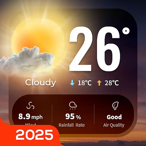
Your Trusted Weather Companion
4.40
Detailed weather info and moon phase, subtle animation, customizable
4.4
No ads, No data collected. Beautiful and powerfully customizable weather app
4.90
Accurate weather forecast, daily weather changes are easy to grasp
4.90
Local weather forecast app, your personal 7*24 local weather forecast assistant.
4.90
Live local weather updates: various widgets & radar maps & hourly forecast.
4.70
Check room temperature with this indoor thermometer. thermostat & hydrometer
4.70
Get accurate rainfall and snowfall totals for pinpoint locations on a map.
4.60
Accurate weather forecast and beautiful weather & clock widgets
4.20
Live weather radar, widgets & forecasts. Track rain, storms & temperature.
4.20
A powerful weather forecast to get real-time weather information
3.60
Instant weather updates, easy to check anytime on your home screen.
3.50


User Reviews